|
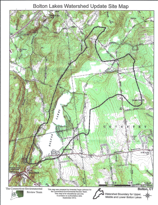
The Bolton Lakes are located in Connecticut's Tolland County, just 14 miles east of the state's capital city of Hartford. The series of three freshwater lakes are located within a watershed in excess of 2,000 acres located in the towns of Bolton, Vernon, Tolland and Coventry.
Individually known as the Lower, Middle, and Upper Bolton Lakes, they are connected by a dam and a culvert with the primary flow of water running from the northern most "upper", through the "middle" into the "lower" and then out into the Hop River at the southern end of the chain. |
Lower Bolton Lake
With a surface area of 175 acres and an average depth of 11 feet, Lower Bolton Lake is by far the biggest and busiest of the trio. Highlights include a public beach and a state-run public boat launch. Lower Bolton Lake Dam is located on the southeast corner of the reservoir, near Indian Notch Park -- 2/3 of a mile south of Middle Bolton Lake Dam. This earth embankment is an
impressive 880 feet long and 18.5 feet high, with a 200-foot concrete spillway and a maximum
storage capacity of 2,325 acre-feet.
Middle Bolton Lake
Middle Bolton Lake is similar to Lower Bolton, but on a slightly smaller scale. It boasts a surface area of 121 acres, a maximum depth of 20 feet, and an average depth of 12 feet. It has a
state-run public boat launch ramp, a town beach and camp. Middle Bolton Lake Dam, a structure composed of both concrete and earth, is located on the southern side of this artificial impoundment. It is fed by waters from the Upper Bolton Lake via a culvert at its northern end as well as four tributery streams.
Upper Bolton Lake
Upper Bolton Lake is the smallest of the three Bolton Lakes, with a surface area of 50 acres. It is
contiguous to the 170 acre Cedar Swamp wetland in Tolland and Coventry and is a major source of water flowing into its two lower sister bodies of water via a spillway underneath a country road. With an average depth of three feet and a maximum depth of 7.5 feet, the body of water is not quite as ideal for boating and water sports as its southern neighbors. Surrounded mostly by marsh, Upper Bolton lacks any significant lakeside developments.

